日本海がみた~い♪♪♪
ということで、
雨飾山に行ってみました♪♪♪

8時28分到着
遠かった~

駐車場です。

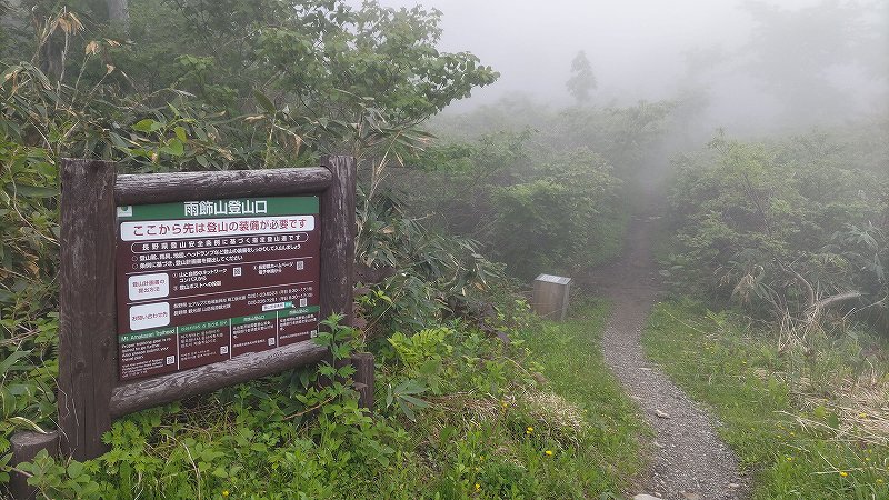
登山口 通過~
最初の数分は、湿原を歩きます。
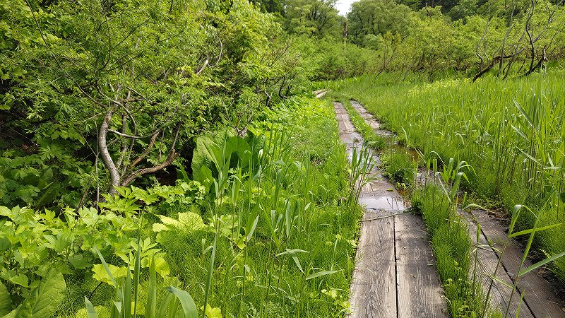
約20分後
登りになりました。
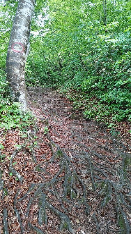
突然の勾配

こんな目印が・・・
これは、3/11、4/11、・・・、11/11と続くのかな?
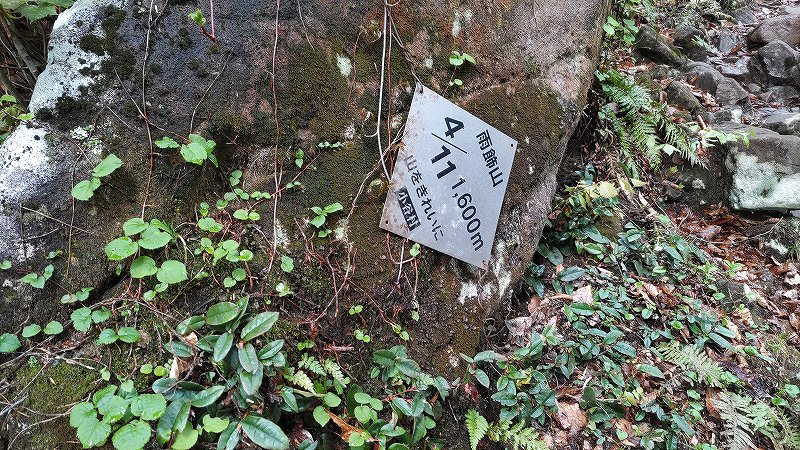
4/11の案内通過
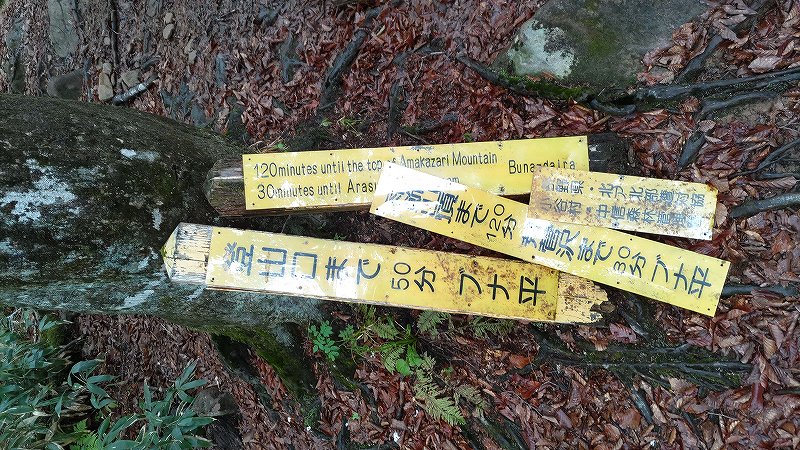
複雑な案内板
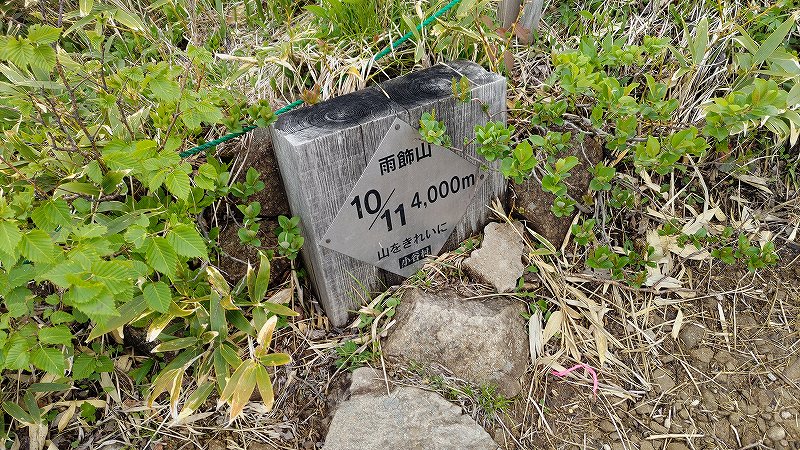
雨飾山山頂まで 120分
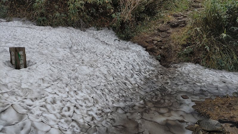
荒菅沢まで 30分
登山口まで 50分
ということで、ここはブナ平なのかな?
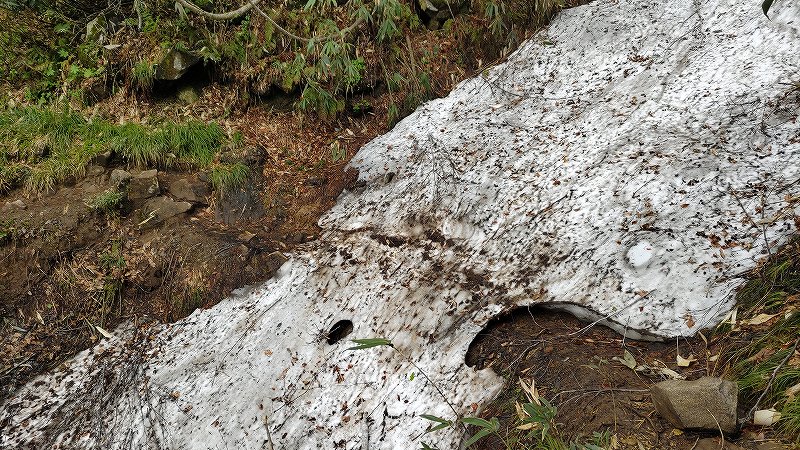
雪、残っているね~
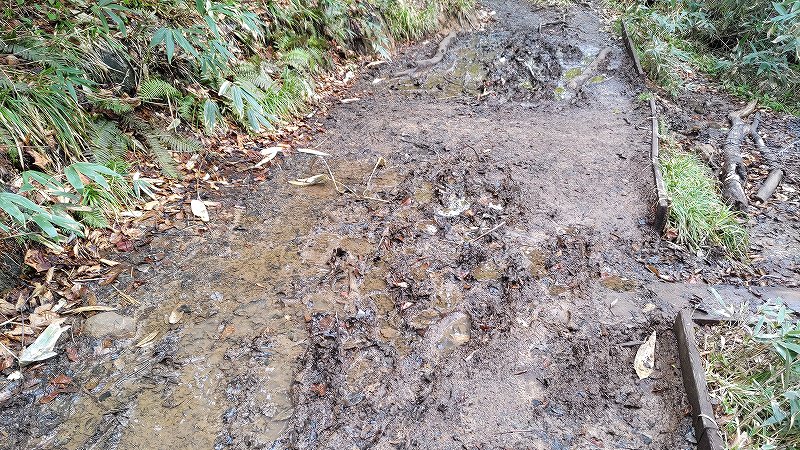
靴が絶対汚れる
ぐちゃぐちゃ道
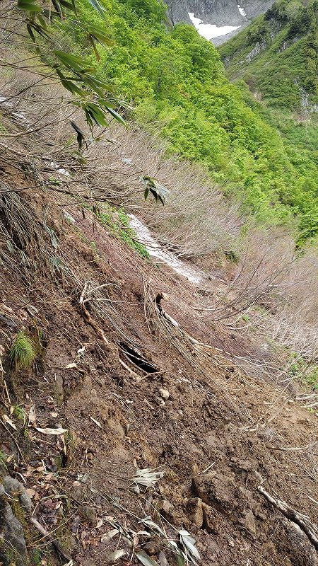
崩落地点あり
9時52分
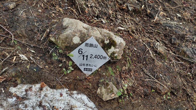
6/11の案内板
雨飾山の標高は2,000m無いので、案内板の2,400mは標高ではないですね!?

結構な雪渓あり
標高低いから、雪は、ほとんどないと睨んでましたが、
結構な残雪で、驚きでした。
先週の唐松岳断念を思い出します。
(まだ、半分登ってないですからね)
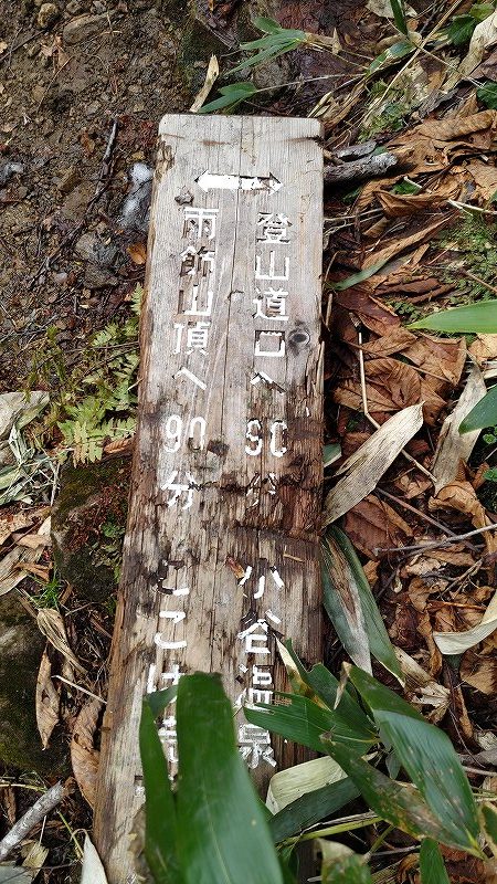
登山口まで90分
山頂まで90分
ちょうど、中間地点みたいですね。
時間的にも90分ちょっと歩いたし・・・。
って、平均的なコースタイムだったんかい。

かなりの雪渓
後から知ったのですが、ここが荒菅沢だったようです。
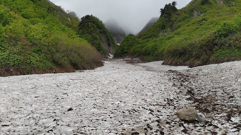
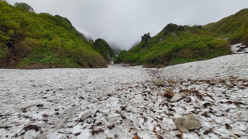
滑ったら、もう戻れないぐらいの傾斜でした。
来年の6月登山(トレッキング)はアイゼン必須やな。

7/11の案内板

8/11 の 案内板

10時58分

樹林帯抜ける~
めっちゃ濃霧やん。
上に行ったら、日本海見えるの?
通りすがりの下山者いわく、「今日は、残念な天気でしたね~」だって
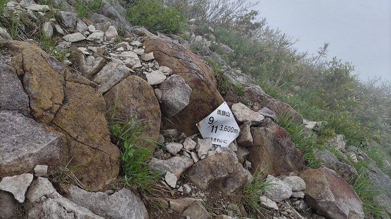
9/11 の 案内板
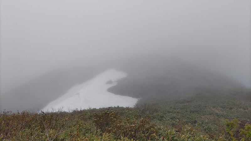
そろそろ山頂か?
だいぶ雪が残っているな・・・
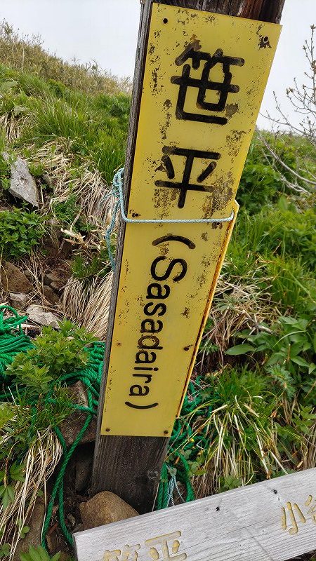
笹平
もう3時間歩いたし、山頂じゃないの?
笹平って、どこ!?

山頂まで40分だって
おかしい、
登山口から180分で山頂のはずなのに、
この案内だと、山頂まで40分、登山口まで(下り)170分だ・・・。
ブナ平の標識、間違っとる?
日本海側(新潟)から登る道と合流
10/11の案内板
もう少しや~

山頂ではないピーク
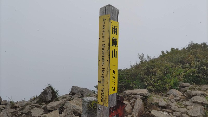
山頂~
標高1963m
めっちゃ霧やから、
1時間ぐらい時間を潰すことに・・・。
待つこと10分ちょい

12時13分

多分、北アの方角、雲海
慌てて、自撮りのセットアップして
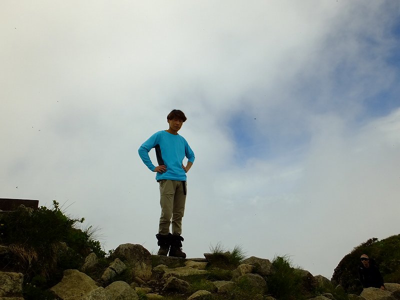
自撮り~
めっちゃ、雲多なってるし・・・。
その後、13時まで晴れることは無く、
日本海方面は、雲に覆われたままでした・・・、残念♪♪♪
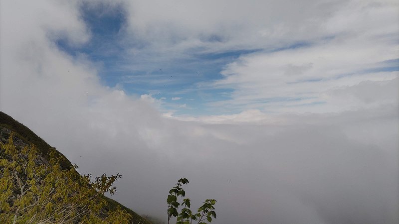
下山途中に、ちょい晴れ間

登山口にもどる。
登り3時間半、下り4時間ちょっとかかりました。
あれ~♪♪♪